Land Surveyor
Land Surveyor
Career Overview
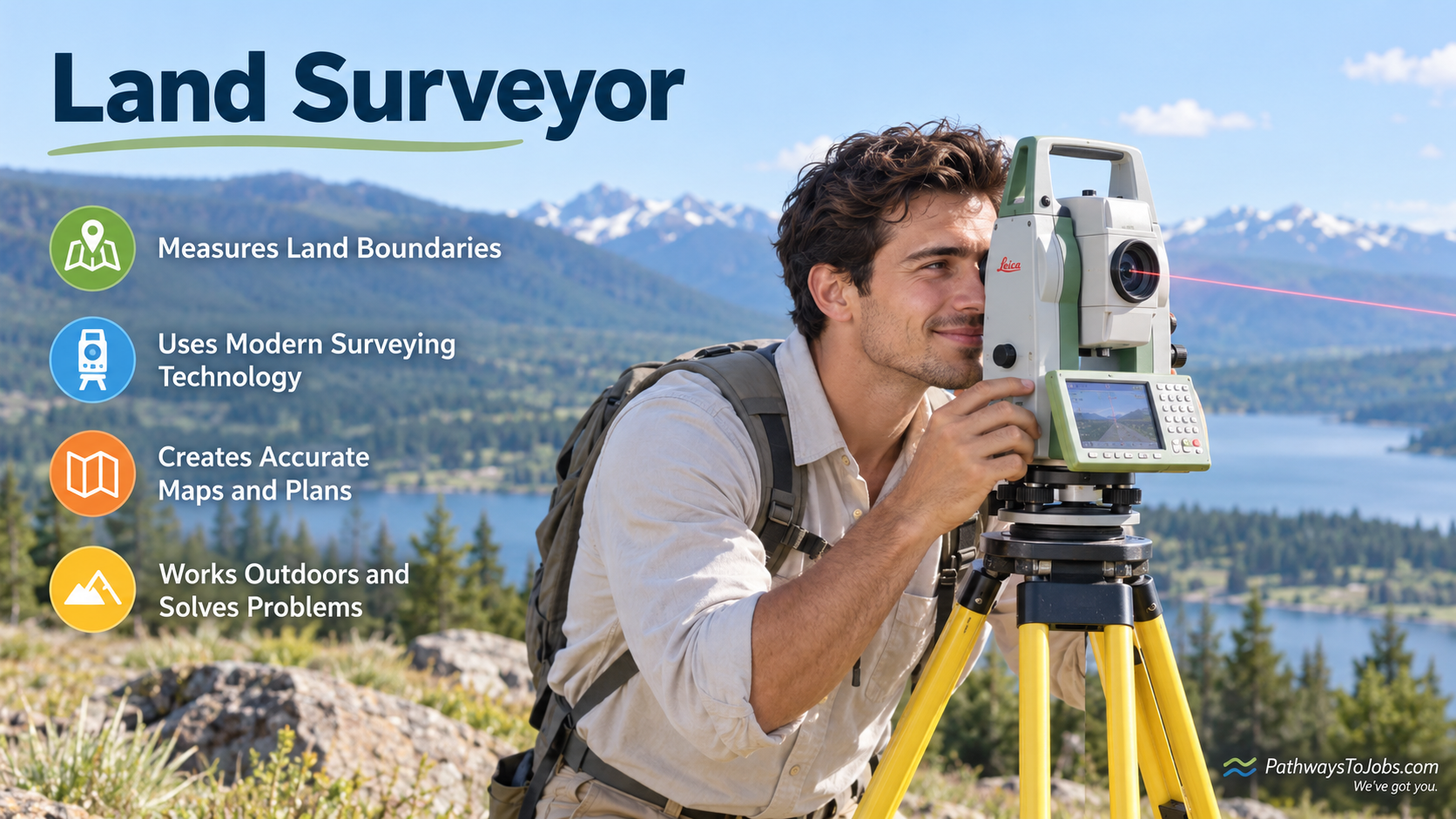
Land surveyors measure and map land to establish property boundaries and determine the precise location and elevation of natural and built features. They use GPS/GNSS, robotic total stations, digital mapping, GIS, CAD, and other surveying technologies to collect and analyze accurate measurements. Drones and aerial imagery are also increasingly used for surveying and mapping, particularly for collecting detailed information over larger or difficult-to-access areas.
Education
Professional land surveying typically requires postsecondary education in surveying, geomatics, surveying engineering, or a related field, followed by practical experience and professional licensing or registration where required. Students learn mathematics, measurement, mapping, property law, surveying technology, and data analysis. Education increasingly includes digital surveying, GIS, GNSS, CAD, and other geospatial technologies.
Work Environment
Land surveyors divide their time between outdoor fieldwork and office-based work. In the field, they may use GPS/GNSS equipment, robotic total stations, drones, and other technology at construction sites, properties, roads, and undeveloped areas. In the office, they process measurements, analyze data, and create digital maps, plans, and survey documents.
Future Outlook
Land surveyors will continue to be needed for property boundaries, construction, infrastructure, land development, and legal surveys. Drones, automated equipment, 3D mapping, GIS, and other technologies are making some surveying tasks faster, but they also increase the importance of professionals who can verify measurements, interpret data, and make legally and technically responsible decisions.
Recommended High School Courses
- Math
- Computer Science
- Physics
- Computer-aided Design Competency
- Geography
- Technical Drawing
- Active Learning - Understanding the implications of new information for both current and future problem-solving and decision-making.
- Active Listening - Giving full attention to what other people are saying, taking time to understand the points being made, asking questions as appropriate, and not interrupting at inappropriate times.
- Complex Problem Solving - Identifying complex problems and reviewing related information to develop and evaluate options and implement solutions.
- Coordination - Adjusting actions in relation to others' actions.
- Critical Thinking - Using logic and reasoning to identify the strengths and weaknesses of alternative solutions, conclusions or approaches to problems.
- Instructing - Teaching others how to do something.
- Judgment and Decision Making - Considering the relative costs and benefits of potential actions to choose the most appropriate one.
- Learning Strategies - Selecting and using training/instructional methods and procedures appropriate for the situation when learning or teaching new things.
- Mathematics - Using mathematics to solve problems.
- Monitoring - Monitoring/Assessing performance of yourself, other individuals, or organizations to make improvements or take corrective action.
- Reading Comprehension - Understanding written sentences and paragraphs in work related documents.
- Social Perceptiveness - Being aware of others' reactions and understanding why they react as they do.
- Speaking - Talking to others to convey information effectively.
- Systems Analysis - Determining how a system should work and how changes in conditions, operations, and the environment will affect outcomes.
- Time Management - Managing one's own time and the time of others.
- Writing - Communicating effectively in writing as appropriate for the needs of the audience.
- Administration and Management - Knowledge of business and management principles involved in strategic planning, resource allocation, human resources modeling, leadership technique, production methods, and coordination of people and resources.
- Building and Construction - Knowledge of materials, methods, and the tools involved in the construction or repair of houses, buildings, or other structures such as highways and roads.
- Computers and Electronics - Knowledge of circuit boards, processors, chips, electronic equipment, and computer hardware and software, including applications and programming.
- Customer and Personal Service - Knowledge of principles and processes for providing customer and personal services. This includes customer needs assessment, meeting quality standards for services, and evaluation of customer satisfaction.
- Design - Knowledge of design techniques, tools, and principles involved in production of precision technical plans, blueprints, drawings, and models.
- Education and Training - Knowledge of principles and methods for curriculum and training design, teaching and instruction for individuals and groups, and the measurement of training effects.
- Engineering and Technology - Knowledge of the practical application of engineering science and technology. This includes applying principles, techniques, procedures, and equipment to the design and production of various goods and services.
- English Language - Knowledge of the structure and content of the English language including the meaning and spelling of words, rules of composition, and grammar.
- Geography - Knowledge of principles and methods for describing the features of land, sea, and air masses, including their physical characteristics, locations, interrelationships, and distribution of plant, animal, and human life.
- Law and Government - Knowledge of laws, legal codes, court procedures, precedents, government regulations, executive orders, agency rules, and the democratic political process.
- Mathematics - Knowledge of arithmetic, algebra, geometry, calculus, statistics, and their applications.
- Public Safety and Security - Knowledge of relevant equipment, policies, procedures, and strategies to promote effective local, state, or national security operations for the protection of people, data, property, and institutions.
- Sales and Marketing - Knowledge of principles and methods for showing, promoting, and selling products or services. This includes marketing strategy and tactics, product demonstration, sales techniques, and sales control systems.
- Arm-Hand Steadiness - The ability to keep your hand and arm steady while moving your arm or while holding your arm and hand in one position.
- Category Flexibility - The ability to generate or use different sets of rules for combining or grouping things in different ways.
- Control Precision - The ability to quickly and repeatedly adjust the controls of a machine or a vehicle to exact positions.
- Deductive Reasoning - The ability to apply general rules to specific problems to produce answers that make sense.
- Depth Perception - The ability to judge which of several objects is closer or farther away from you, or to judge the distance between you and an object.
- Far Vision - The ability to see details at a distance.
- Finger Dexterity - The ability to make precisely coordinated movements of the fingers of one or both hands to grasp, manipulate, or assemble very small objects.
- Flexibility of Closure - The ability to identify or detect a known pattern (a figure, object, word, or sound) that is hidden in other distracting material.
- Inductive Reasoning - The ability to combine pieces of information to form general rules or conclusions (includes finding a relationship among seemingly unrelated events).
- Information Ordering - The ability to arrange things or actions in a certain order or pattern according to a specific rule or set of rules (e.g., patterns of numbers, letters, words, pictures, mathematical operations).
- Manual Dexterity - The ability to quickly move your hand, your hand together with your arm, or your two hands to grasp, manipulate, or assemble objects.
- Mathematical Reasoning - The ability to choose the right mathematical methods or formulas to solve a problem.
- Near Vision - The ability to see details at close range (within a few feet of the observer).
- Number Facility - The ability to add, subtract, multiply, or divide quickly and correctly.
- Oral Comprehension - The ability to listen to and understand information and ideas presented through spoken words and sentences.
- Oral Expression - The ability to communicate information and ideas in speaking so others will understand.
- Perceptual Speed - The ability to quickly and accurately compare similarities and differences among sets of letters, numbers, objects, pictures, or patterns. The things to be compared may be presented at the same time or one after the other. This ability also includes comparing a presented object with a remembered object.
- Problem Sensitivity - The ability to tell when something is wrong or is likely to go wrong. It does not involve solving the problem, only recognizing there is a problem.
- Selective Attention - The ability to concentrate on a task over a period of time without being distracted.
- Spatial Orientation - The ability to know your location in relation to the environment or to know where other objects are in relation to you.
- Speech Clarity - The ability to speak clearly so others can understand you.
- Speech Recognition - The ability to identify and understand the speech of another person.
- Speed of Closure - The ability to quickly make sense of, combine, and organize information into meaningful patterns.
- Visualization - The ability to imagine how something will look after it is moved around or when its parts are moved or rearranged.
- Written Comprehension - The ability to read and understand information and ideas presented in writing.
- Written Expression - The ability to communicate information and ideas in writing so others will understand.
- Verify mathematical calculations.
- Direct surveying activities.
- Document technical design details.
- Create maps.
- Gather physical survey data.
- Coordinate activities with suppliers, contractors, clients, or other departments.
- Calculate geographic positions from survey data.
- Calibrate scientific or technical equipment.
- Survey land or bodies of water to measure or determine features.
- Train personnel on proper operational procedures.
- Analyze physical, survey, or geographic data.
- Testify at legal or legislative proceedings.
- Determine operational criteria or specifications.
Schools


Potential Scholarships
Approx Salary Expectation


References
Trend Analysis - Explorer the Market, Labour Market Information, Government of Canada https://www.jobbank.gc.ca/trend-analysis.
O*NET OnLine, National Center for O*NET Development, https://www.onetonline.org/.